Friday, April 30, 2010

Movin' on from Charleston

     A whole week has passed since my last post and I wish I could tell you that my reason for not writing was that we were so busy with exciting things to do and places to see, but sadly that was not the case.  We have been attending the AGLCA meetings (that's the "Loop" group we belong to) for the past week (more on that later), but we are on the move again and I want to bring you up to date, so here goes.
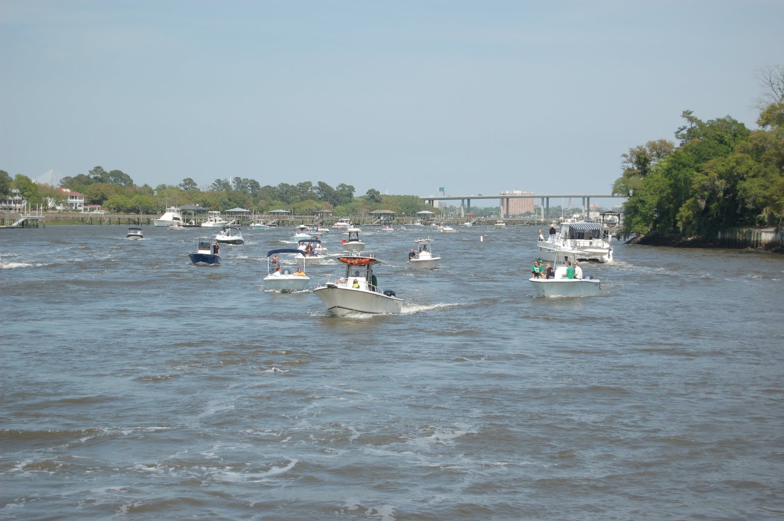
     We left Charleston in the wee hours (for me, that is anything before 9 am) and once again headed North on the ICW.  Not much happening here, but the scenery was beautiful as we cruised through the South Carolina swamps, with a few diversions, as you can see in these photos:

We love the cypress trees covered with moss--this was at high tide.

And not too much further, the trees disappeared and we were back in marsh land.

And just as suddenly, along came this group of kayakers.  We have no idea where they were coming from (or going to) because we were still in the middle of nowhere.  God love them--they will be paddling their little arms off for a long time, but they seemed happy enough, although too occupied to wave.

Here we are still in the middle of the marsh, and up comes this sign.  Obviously there are not a lot of roads in this area, so I guess if you want to go anywhere, you catch a ferry.  And here she is:

Not too impressive, huh?  No passengers or vehicles today.

     Not too much else went on as we journeyed toward Georgetown (our next stop), but we were joined by this flock of seagulls who escorted us for quite awhile, squawking all the way.  And of course, one of them made the obligatory donation on our deck, which Art dutifully scrubbed off when we docked.


     Our stop in Georgetown was recommended by some other boaters we met along the way, and for the life of me, I can't figure out why.   The dockmaster squeezed us boaters in pretty tight and so there was little privacy and everyone was pretty grumpy about how they were going to get out the next day.  I went up on the flybridge to enjoy the view and the first thing I spotted was this critter slowing swimming across the water:


     You'll have to use your imagination again, but that is an alligator cruising slowly beside the sailboat.

     We got off the boat for our obligatory walk and to discover this town.  They have built a boardwalk along the river, but after a day on the water, last thing we wanted to do was stroll the waterfront, so we headed in to the main street.  Here's photos of both:

 
The boardwalk.


Front Street, Georgetown

     In all fairness to Georgetown, I guess there are many beautiful plantation homes nearby to visit and they have built this beautiful little park, cannons and all:


And even better, check out the sunset over Georgetown :


Tomorrow we journey to North Myrtle Beach, S.C. for the AGLCA meetings.

Saturday, April 24, 2010

Charleston, S.C., Chapter 2

     Here is a very short summary of the founding of Charleston.  The city was settled by English colonists (and a few slaves from Barbados) in 1680, on what was known as Oyster Point (still lots of shells there).  The colonists named the city after King Charles II (they first called it Charles Town), who was happily sitting on his throne on the other side of the ocean.  And if you want to know anything more about the history of Charleston from then until now, you need to visit the city or read your history book.  Too much other stuff to cover in this small space.
     Charleston's nickname is "The Holy City," both because there are so many churches and because the skyline of the city is dominated by church steeples.  Here is St. Philips Episcopal Church, one of the oldest in the city.  Now just picture the skyline dominated with beautiful steeples like this one (and the photo below).  You have to "just picture it" because I forgot to take a photo!


     If memory serves me, this church sits on one of the highest points in Charleston--a whole 20 feet above sea level--not exactly like the hills in San Francisco, but our tour guide thought it was a big deal to take us to "the top of the hill" to see the church.
      Before I end the topic of churches, Charleston has the very "first" First Baptist Church, founded in 1682.  All the rest of the First Baptists came after that.  I thought that was interesting.
     Moving on.  Art spent part of a day at the Patriots Point Naval & Maritime Museum, which is best known as the home of the World War II aircraft carrier Yorktown.  He toured the ship as well as the submarine Clagmore  (most famous for patrolling the waters around Cuba during the tense US/Soviet relationship in 1962).   Here are some photos of the ship, its planes and the submarine.
    
The USS Yorktown


F-4 Phantom on the Yorktown flight deck

Submarine Clagmore

     Traveling from our marina to Patriots Point, Art had to cross what is one of the most beautiful bridges we have ever seen (okay, so the Golden Gate still gets our first place vote, but the beauty of this one rivals it in many ways).  Anyway, it is the longest cable-stayed bridge in the Western Hemisphere and was the most prominent feature in the view from our boat.  We loved it day and night, as you can see below.


     One more thing I forgot to mention when I was writing about the architectural charm of Charleston, was the cobblestone streets.  They were made from the ballast of ships bringing goods into the city in the1700's.  They really are charming, but not too cool to walk on--I nearly fell on my face numerous times trying to walk and take in the beauty of the street at the same time.  Here's one of my favorites:


      A few more odds and ends before I end this long post.  The restaurants in Charleston rival any in the U.S. and we dined like kings (and queens).  We had a spectacular meal at Magnolia's and it seems everyone in our marina as well as the other boaters we met in Charleston raved about that very same restaurant (thank you Robin for letting us know about this one).  Since arriving in the Low Country, I am eating my way through Shrimp & Grits, and each dish I have had so far has been different, yet wonderful.  So far Magnolia's wins.  We also had a fabulous meal at Virginia's on King (also thanks to Robin), with a new twist on my favorite dish--shrimp, fried green tomatoes and grits.  Wow is all I can say.  We barely touched the list of fine dining there, so come prepared to eat when you visit.
     At last, I am done.  Charleston is special.  I was called "Sweetie" so many times there, I was beginning to believe it.  This is one place we will return to!
     Next we are off to Georgetown, S.C. and then on to Myrtle Beach, where we will stay for 5 or 6 days while we attend the Spring get-together of the Great Loop organization.  We hope to learn a lot more about the remainder of our trip at this meeting, as well as meet a few people who will be traveling the route along with us.

Friday, April 23, 2010

Charleston, South Carolina

     I'm getting a bit behind in updating this blog and my reason is that we have been having so much fun in Charleston.  I have always wanted to visit this city, from the time I lived in New Orleans in the 1960's (where many comparisons to Charleston were made) up through last summer when Art and I came here on one of our road trips. On that visit, we were unable to do any sightseeing because it rained like hell for 2 days straight and we gave up hope that we would ever be able to get out of the car.  So I'm glad we had this opportunity to come back.
     This update begins last Sunday (4/18) when we left Beaufort and meandered up the Intracoastal towards Charleston.  That part of the trip was pretty uneventful, save a boat leading us around a dredging barge and the occasional shallow water that raised our blood pressure until the depth sounder again registered numbers that allowed us to breathe.  Everyone talks about being grounded at one time or another, but it is an experience we hope to avoid.
     As we neared Charleston, we were given a dose of Southern Hospitality that was way beyond our expectations.  In the photo below, look at all those Charlestonians rushing up to us in their boats to welcome us to their fair city:


     Okay--moment of truth.  The Charleston Air Show was going on that day and the Blue Angels performed on both Saturday and Sunday.  Most of these folks had taken their small boats into Charleston Harbor to watch the show (the Blue Angels performed over water) and were on their way home as we approached.  For a while there, I thought we were back in Los Angeles traffic--there were boats everywhere and all were pretty bad drivers at that (probably too full of beer to pay attention).  We had a few near misses and lots of excitement, but we obviously made it through unscathed.
     We docked at the Charleston Maritime Center near the historic downtown area and were doing our usual "getting settled" routine when I heard a lot of noise.  I looked up to see the Blue Angels team with a lead plane flying very low right towards us.  We could almost see the pilots, they were so close.  I was jumping up and down, screaming and carrying on like an idiot when it suddenly occured to me to take a photo.  By then, they had passed, but I still captured their formation:


     We spent our first two days in Charleston taking care of boat related odds and ends.  And finally it was time to be tourists.  Chareston has taken the concept of "charm" to its limits.  It has cobblestone streets, historic homes and buildings, churches up the wazoo (more on that later), beautiful gardens and a waterfront area with no rivals.  Here was one of the first sights we saw off the boat:

There were flowers and decorative wrought iron everywhere.


     The fountains were spectacular, but as I walked next to one in the waterfront park, I found a sign with the park rules that included:
     *Swimming in the fountains only from 6 am to 12 am
     *No more than 25 people allowed in the fountain at one time
     *No spitting or blowing your nose in the fountain
and a few others that I thought must have been written in the 20's, or as a joke, but they were serious.  Here is a shot of the next fountain I came across, complete with the usual beach warning:

No swimmers today.

     The real tourist fascination for us was the architecture, specifically the houses.  In Charleston, they are called "single houses,"  known in a lot of other places as "shotgun."  They are one room wide and built to avoid the sun and capture the breezes.  From the street, there is a "proper" front door, but it opens up onto a porch, which they call a "piazza." Check out the photos below and you can see what I mean:


     For now, this is my introduction to Charleston.  I have lots more to share and will continue tomorow.  So hang in there for Chapter 2...

Tuesday, April 20, 2010

Goodbye Georgia, Hello South Carolina

     A little less than 15 miles after leaving of the Isle of Hope, we cruised into the Savannah River which marks the boundary between Georgia and South Carolina.  I honestly can't say I noticed much difference.  The "Low Country," as this area of the southeast is known, looks pretty much the same (in a very beautiful way) wherever you go--marshes, saw grass, pines in the distance, wide waterways and very little signs of human presence.  It really is quite mesmerizing to just float along and enjoy it.
     Just south of our next destination, Port Royal Marina near Beaufort, S.C., is Port Royal Sound, said to be the deepest natural harbor south of Chesapeake Bay.  Our crossing was in good weather and fair winds--just lots of water everywhere, as you can see:


     Here we are (in the photo below) approaching the marina a short while later (notice I have my lines out ready for docking all you boating friends--fenders still up, though):


     Port Royal is also a town, separated from Beaufort only by the width of a signpost at a Burger King on Ribault Road, which runs through both towns.  But Beaufort gets the attention, and for good reason.  It is another historic area with beautiful restored homes, but it also has a lot of modern-day claims to fame.  It has a naval hospital and Marine Corps Air Station that is home to seven F/A-18 Hornet squadrons (wadda ya' think, Jeff?).  It is even more well known for the movies that have been filmed here:  Forrest Gump, The Big Chill, Prince of Tides and The Great Santini (the last 2 were written by local author Pat Conroy--a factiod for Karen and all my Barnes & Noble friends).
     Once we were docked, we went for our usual walk to the Piggly Wiggly (yeah folks, there really is a grocery chain by that name in the South).  We also stopped at a seafood stand at the side of the road and bought shrimp, flounder and freshly boiled peanuts from a local fisherman.  We had the flounder for dinner and it was like nothing I ever cooked before.  Here is a photo of Art, hauling his half of the groceries, as we walked back to the boat through a beautiful neighborhood right by the marina:


     This last photo is of our marina at low tide--amazing how much water disappears when the tide here goes out.  We just don't see these kinds of tides on the West coast.


     Our next stop is Charleston, a city I am really excited about visiting.  We will spend a few days there enjoying the sights and the food, so that will be my next post.

Saturday, April 17, 2010

Isle of Hope, Georgia

     I think I was a little harsh in my last blog when I said there wasn't much to do or see along coastal Georgia.  Our 2-day stay at the Isle of Hope Marina near the northern border of Georgia certainly opened my eyes to some really special things about this area (and how can you say bad things about a place with such a positive name?).  The marina is in a village of the same name--a quaint little place with winding roads, restored houses, tall pines and old oak trees draped with moss.  A few photos will tell the story better than I can, so here they are:

 A view of the Isle of Hope Marina on the Skidaway River.

 The view from our boat toward the town.

Looking in the opposite direction, upriver from our boat (nearing low tide).

The tides in this area are huge: 7 to 9'.  At high tide, this diagonal ramp will be nearly level.  Right now, the dock is partially sitting on the mud bottom.

 This road runs parallel to the river at the top of the marina.  This is where we walked.
     
     We have been trying to take long walks at each of our stops, which is a great way to see the area around the marinas as well as stretch our rubbery legs after long hours on the water.  A lot of people complain that they really get out of shape from being on a boat, but we are finding the opposite and credit our long walks (often hauling sacks of groceries or other needed supplies) for keeping us in some kind of shape.  Another bonus for me is that my balance has improved dramatically since being on the boat.  I guess trying to stay upright in choppy seas while walking around on deck challenges your equilibrium and now when I am on land, standing on one leg is a piece of cake (I used to have to hold on to something).
     Getting back to the photos, here are some of those beautiful homes we walked past along the river:


     Last of all, here is a sight we have yet to get tired of--beautiful old oak trees draped with Spanish moss (which really isn't moss at all and was named "Spanish" because the Indians thought it looked like the beards of the Spaniards who first discovered the area):


      One last note about our journey into Isle of Hope.  A few miles downriver, we passed St. Catherine's Island.  The Island is privately owned and visitation is very limited.  Part of the island is used as a survival center for endangered species (St. Catherine's Island Foundation along with the New York Zoological Society).  It seems the climate there is conducive for breeding several endangered species such as gazelles, parrots and Madagascar turtles.  Just what I thought Georgia needed--more gazelles, parrots and Madagascar turtles!  I wonder what they do with them?  Haven't found that out yet, but keep posted and I will let you know.


.

Thursday, April 15, 2010

Georgia (the Peach State)

     For the past two days, our trip has been all about the journey and not the destination.  Since leaving Fernandina Beach Wednesday morning (April 14), we have been faced with some new navigational challenges, so we have focused our energies on studying the charts and tides to plan our trip (aren't you impressed?).  But that is not the only reason we have been journey-oriented:  there just isn't a whole lot to do or see along the coast of Georgia.  Here's a short summary of the last two days:
     On Wednesday, we got up before dawn (not my choice) and we were off before daybreak to catch the high tide and get through some potentially rough-water areas before the wind picked up.  A short distance out, we passed a submarine base and the mandatory Navy patrol boat guarding the entrance.  I would have taken their picture, but I thought they might shoot me (not the friendliest guys on the planet).  We then took an alternate route around St. Andrew Sound (which is an outlet to the Atlantic Ocean and consequently a much more difficult area to navigate),  and as soon as we turned onto our new route, we saw some wild boar--four in all, and I assumed it was mom, pop and two babies.  In the photo below, you can only see mom and dad (black dots) because the kids are hidden in the grass (mom and dad are are pretty well hidden too, but use your imagination).

  
     This photo is also a summary of the scenery for the last two days--water, grass and an occasional tree.  But here is one more picture of a scene we saw constantly--birds nesting on the channel markers:

  
   We stopped for the night at Jekyll Island and it was nice, but nothing remarkable, and a little on the "rustic" side.  Our first task was to wash the boat, and boy was it dirty--and boy, is it big!  I helped a bit, but Art did the lion's share, photo below:


     We ate dinner at the Sea Jay Cafe right there at the marina and had a Low Country Shrimp Boil (shrimp, sausage, potatoes and corn, along with cole slaw and rolls).  It was "all you can eat" and I would certainly earn a gold star for what I packed away!
     Next morning was up at dark again and off before sunrise.  We had a few more tough areas to navigate and a long journey--over nine hours on the water.  We are now at the Isle of Hope marina near Savannah.  Tomorow we will hang out here to rest, do laundry, and find a grocery store (the marina has a "loaner" car for us to use, so I am off in search of a Walmart Supercenter to restock!)

Tuesday, April 13, 2010

The End of Florida, Amelia Island

     We are now in the northeastern most corner of Florida in Fernandino   Beach, the only city here on Amelia Island.  It is a quaint little town (population 11,200 or so) with lots of little shops, great restaurants and the oldest saloon in the state (first thing we spotted).  This photo was taken from our boat looking at the Atlantic Seafood shop, where we stocked up on fresh shrimp hauled in by the shrimp fleet moored just before entering the marina (I was too busy looking for lines to tie us up and missed the opportunity to get a picture of the shrimp boats).
     We spent our first day here touring the shops and ended up in the coolest market (Fred's) at the far end of downtown.  They had everything you can imagine in that store: artificial flowers for the cemetery, lawn furniture and camping equipment, food, drugs, clothes and shoes, televisions, toys, home decor (some pretty ugly stuff), school supplies, and on and on--real competition for Walmart, only on a smaller scale.  I could have spent a whole day in that store!

     This is the main street (Centre Street) through the historic district.

   On the recommendation of friends, we went to T-Ray's for breakfast this morning.  The restaurant (and I use that word loosely) is in an old gas station and I think we were sitting about where the service bay used to be.  I don't even know what to tell you about the place--it was that unique (no two tables were the same, none of the dishes or silverware matched, and everyone was incredibly friendly).  Definitely local home-cookin' cuisine here, as you can see in the photos below:

Art waiting for our order to arrive.

Can you believe we ate this?  Eggs, sausage, cheese grits, and a grilled biscuit.  Yummy

     Tomorrow we head out on the water once again gong north, so this evening we will just sit on the boat and enjoy the view (and a little wine).  Here is our location at the Fernandina Harbor Marina (as you can see, our view is water everywhere):

We are the fourth boat from the right, behind the blue sailboat.

Sunday, April 11, 2010

St. Augustine, Florida

     St.Augustine bills itself as the oldest city in the U.S., but it is perhaps better known as the site where Ponce de Leon landed in search of the Fountain of Youth.  I've been searching for it too, but so far, no luck.  I'm not a real history buff (Art is, but he's not writing this), so I'll just say that our location in what is called the "Old City" is quite interesting and has that colonial feel:  narrow streets, old stone buildings and lots of statues and plazas.  We do plan to take a guided tour, so I'm sure I will have more to say on this later.
     We are docked at the St. Augustine Municipal Marina, which is located right next to the historic Lions Bridge in the downtown (Old City) area.  As you can see in this photo, we run into all kinds of boats--this guy is basically a pontoon boat with a tent on top and he too is doing the Loop, albeit rather slowly (will finish in a few more years, as money and time permit).  We have seen all kinds of watercraft going our way and we have heard from others that we will continue to be amazed at what floats down the "ditch," as the ICW is often called.  I can't wait and promise to keep my camera handy!
     Our first day here, we walked around a bit and then took a tour of the Castillo de San Marcos, an old Spanish fort located on the water which, in its 350-plus years, was never defeated by any attacking force.  It is now part of the National Parks system.
     
Here I am with my new fortress friend--nice guy.
Art is checking out the cannons.  We were told they could shoot 3 miles, but were accurate for only a couple of hundred yards
We are looking down into the courtyard from the gun deck in this shot.

     In addition to all the great historical sites, this city has fabulous restaurants.  I'd like to eat at every one of them, but then I would be as big as the boat.  So far our favorites are Harry's (Low Country Shrimp and Grits gets my vote, Art had Jambalaya) and O.C. Whites, which is located in another historic building (built in 1790).  I had flounder and Art got Shrimp Abaco which was to die for.  As you can guess, we have been eating a lot of seafood (almost exclusively when we go out), so I'll be seaworthy even without a boat!

 Last Day in Saint Augustine
      As I mentioned above, we took a guided tour of the city today, but I won't bore you with the details of the names of the all historic buildings we saw and what they have been used for over the past 250 years. (I wish I had gotten a photo of the cute little train we rode around in, though.)  The best part of the tour was a side trip to the St. Augustine Lighthouse.
     We learned from photos in the Lighthouse Welcome Center that the view at the top was fantastic, but that you had to climb 220-plus stairs (the equivalent to a 15 story building).  Whoa--neither Art nor I are exactly athletes, but I decided we must do it anyway and so I shamed Art into making the climb.  And once we were on the way, he had to keep coaxing me along (my knees and lungs were protesting) or I would have jumped out the first window I could find.  One lady told me to breathe slowly on the exhale, but I told her I felt lucky to be breathing at all.  Obviously, we finally made it to the top, but I sure had a few doubts along the way. As you can see from the last photo below, the view wasn't as fantastic as promised -- I thought it looked like we were only a few feet off the ground, but the sense of victory over those damn stairs was enough to keep me happy.  I was also amazed that walking around a catwalk at the top with only a small railing wasn't nearly as scary as it looked from below.  In spite of my whining, I enjoyed every minute in that lighthouse.

This is what our climb looked like from the bottom looking up.


Can you believe I am posting this photo with both of us looking so bad?  But that is as good as it gets when you are out of shape and climb 220-plus stairs going in a circle.