Monday, May 31, 2010

Portsmouth, Virginia

     Portsmouth isn't just a Navy town any more--well, yes it is, but it also has a few other assets.  It is Zero Mile Marker on the ICW, the midpoint between Miami and Maine (along with Norfolk which is directly across the river); it is located on the world's largest and deepest natural harbor; the first ferry service in America started here in 1636; and it has a larger collection of architecturally significant 18th and 19th century houses than any other city between Alexandria and Charleston.  End history lesson.
     We stayed at the Ocean Marina near the Olde Towne Portsmouth historic shopping and entertainment district (don't you love how they stick an "e" at the end to make the area sound more quaint and historic?).  There was plenty to do and see within walking distance, so off we went, and once again our photos will tell the story.

Our view from the marina--more Navy.  This was taken from the back of our boat looking across the Elizabeth River.  The Norfolk skyline is on the left behind the ship.

     We first arrived in Portsmouth on Friday, and on Saturday, there was an Arts & Crafts fair on the main street (High Street).  We resisted temptation and didn't buy an object d'art for the boat, but had a lot of fun looking and stopping at the junk food stalls (almost as good/bad as a county fair).

That's Art on the right in the brown shirt and shorts.

And here I am on the phone (with one of the kids, no doubt) in front of historic Trinity Episcopal Church, erected in 1762 and originally the Portsmouth Parish of the Church of England.

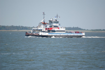
This is a view of Norfolk from the ferry we took over.  The ferry costs $1.50 each way, but was half price for us old duffers.  We went over to go shopping and for Art to tour the USS Wisconsin (next photo).


     Back in Portsmouth, this next photo is of a lightship--basically a portable lighthouse--now sitting on land as a museum exhibit.  Typically, a lightship would anchor at a strategic location at sea and remain in one spot for months at a time helping mariners avoid dangerous shoals or to safely enter harbors at night.  This particular ship served for 48 years off  the coasts of Virginia, Delaware and Massachusetts. 


     When we got tired of being tourists, we headed back to the boat and met up with a few other friends in the marina for "docktails," which is turning out to be a pretty common activity when we tie up (oh, darn).

We are a rather scruffy looking group, wouldn't you say?  But everyone has a drink in their hand!

This is the sunset right after a downpour in the marina on our last night in Portsmouth.  Portsmouth is the gateway into the Chesapeake, so off we go--and that will be my next post.

Friday, May 28, 2010

On to Portsmouth, Virginia

     It's time to head out of the rural, swampy, marshy waterways of North Carolina and into the urban/industrial area around Portsmouth and Norfolk, Virginia.  With our bellies still full of prime rib from the night before (we each had a 16-oz serving, but did take home leftovers), we were off at a reasonable hour on another gloomy day.  This leg of the journey required some planning--there are 5 bridges that have to be opened on a variety of schedules, as well as one lock (our first) to go through.  So off we went.
     We had to idle in the water around a few of the bridges (sometimes fighting the current and winds which kept Art on his toes and me biting my nails), but all went well enough.  Then came the lock--and here we are in the photo below with Art holding the line at the back of the boat:


     When you enter the lock, you have to head for one side or the other and then wrap a line around those yellow cleats on the wall.  Getting the bow line on was my responsibility while Art maneuvered the boat into position.  We were a lot lower in the lock than when this photo was taken, so the cleat was pretty high up.  I tried the cowboy-style lasso technique to get the line over, but missed every time (calf roping will not be in my future) and finally had to grab a hook on the side of the wall, pull us over and wrap the line around.  Then you just hang on and pull in the line as the water level changes.  And when it is done, the lock gates open and off you go.  Having mastered the first lock, albeit in a very clumsy manner, I am ready for the next 150 or so locks we will encounter on this journey.
     As we passed under the last of the bridge openings (next photo), the scenery changed dramatically.  You get the idea just from the cranes in the distance:


     We are now in the land of commercial shipping, Navy shipyards and lots of traffic on the river.  We first encountered a "graveyard" of wrecked ships, which was not the best omen for the journey to come, but on we went.


     And then came our first look at the Portsmouth area with Navy ships everywhere, mostly heading into (or already in) gigantic floating dry docks:


     We docked right across the river from the Navy shipyard and this vessel got our immediate attention:


     This is a radar evading warship, as you can see by all the flat surfaces and angles, one of the Navy's newer vessels.  And here is one more ship on the way into the dry dock:


     Now it is time to discover what else, besides Navy ships, that Portsmouth has to offer and that will be my next post.

Monday, May 24, 2010

Moving on through North Carolina

     The next few days, cruising up the North Carolina coast, presented us with our first really crappy weather.  For three days, the skies were overcast, we had on and off rain, and way to much wind for my comfort.  There were few opportunities to take photos--dreary gray weather on the water is even worse than dreary gray weather anywhere else--even the water turns gray (along with my mood), so I will just mention where we went and include, at the end, the only picture taken over these three days.
     First stop out of Beaufort was a small town called Bellhaven.  Small town says it all about this place--and it wasn't even "historic."  Best part was the marina shower rooms and the men's were especially unique, so I will relate what Art told me about them.  They were decorated with World War II memorabilia from three Navy families, including photos, newspaper articles, official documents and personal letters.  One sailor served on a aircraft carrier, the second on a destroyer and the third on a supply ship.  These were real people and the documents and pictures were authentic.  Art especially enjoyed reading the letters to and from the sailors and their parents and girlfriends.  I honestly think he could have spent the day in there.  But since I didn't find Bellhaven (and the lousy weather) all that exciting, we moved on the next morning.
     Our next stop was Alligator River Marina, and guess what?  It was along the Alligator River--although we didn't see any (must have been the bad weather).  This marina was tiny  and we ended up parked behind a Shell station--a pretty funny place to end up when you think you are on this really cool trip and everyone wishes they could be with you.  Docked behind a gas station was not the most impressive place we have been--and there was nothing else there.  Obviously, it was time to move on again.
     Day three out of Beaufort brought us to another tiny place called Coinjock.  It was a tough day on the water.  We had to cross the Albbemarle Sound (a pretty big body of water for being inside the barrier islands) and it was rough.  The winds were up and the seas very choppy--it was the first time on this journey that we had things flopping around in the boat and we had to put everything back in order when we stopped (although the photo frame holding my favorite picture of Gregg, Lauren and their kids bit the dust).
     Coinjock's claim to fame is the prime rib served in the restaurant at the marina (which is all that is there).  We met a couple on the docks who had driven two hours from Virginia Beach just for the meat--whoa.  They slow roast it all day and with that kind of reputation, I wasn't going to miss this one.  The meal was indeed great, but we've had some pretty good prime rib in other places too.  (Translation:  it wasn't worth a two hour drive, but it sure beat the hell out of cooking on the boat).
     This lonely photo was taken by some friends as we pushed off the dock at Coinjock, heading to our next stop:  Portsmouth, Virginia (where we took lots of photos!).

This was the first decent weather day.  Art and I are at the helm on the flybridge and you are looking at the back of our heads (some of our best features).  Portsmouth next.

Saturday, May 22, 2010

Beaufort, North Carolina

     Here I am on the waterfront in Beaufort, NC, another waterfront village that likes to call itself "historic," and so here is a very short history lesson:  Beaufort was founded in 1709 and is the third oldest town in North Carolina.  It has a sea-faring, boat-building, and fishing heritage that also includes pirates--most notably the famous Blackbeard who plied the waters here for many years.  On a side note, Blackbeard's flagship, the Queen Anne's Revenge, was discovered in the late 1990s only 2 miles from Beaufort's waterfront and is a major tourist draw (they limit the number of divers who can go down to see it).
     The heart of the city is Front Street, along the waterfront, where you can find the usual collection of restaurants, gift shops, art galleries, pubs and quite a few restored Victorian buildings and homes.  Once again, I will let photos tell the story.

  
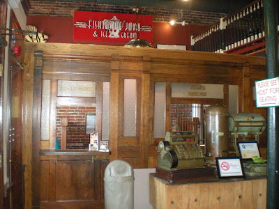
     This is a shot of Front Street, which looks to me a lot like any other main street in small town America.  In the middle is Clawsons (red sign) which is a very good restaurant (more shrimp & grits for me, flounder for Art) located in a building that has a long history.  All variety of shops and services have been housed there, and you can see much of this history inside the restaurant like the photo of the entry below:


     Next on my brief tour of the city are a few of the old homes that we always enjoy seeing in these small towns--and knowing they are there is what gets us out for that much needed walk after a day on the water.


     Going back to the marina, I have a few more photos of the waterfront to share (mostly because it was really very nice and definitely scenic):

A look at the small park that separates the marina from Front Street.  The building on the left is a dock-side restaurant and bar.  The marina gave us tokens for free beer, so we spent our last night there downing a few with fellow boaters who we had met along the way.

     Here is our boat in the marina with art swabbing the upper deck (okay, so no one uses that term any more, but I couldn't resist and he was in the process of washing the boat anyway when I took this shot).  Another interesting note:  the sailboat to the left of us came across the Atlantic from England!  It was owned by a very nice young couple and I can't believe they were brave enough to sail all that way in a relatively small boat.  
     And just when we were thinking we had a pretty nice boat ourselves (and not so small either), along came this monster and we were instantly humbled:

That's our little boat on the far left.

     Back to a little more history for my last note on this stop.  Only a block off Front Street is the Beaufort Historical Association offices and they have a small park where several of the more famous old buildings have been located and restored.  Here is Art in front of the jail, which was used until the 1950s!!


     But even more interesting was the cemetery, the Old Burying Ground, which is listed on the National Register of Historic Places.  It was deeded to the town in 1731, but some of the graves are much older.  Buried here are soldiers from the Indian wars, the Revolutionary War, the War of 1812 and the Civil War (both Union and Confederate soldiers) as well as local citizens.  Most of the graves face East because those buried there wanted to face the sun when they arose on "Judgement Morn."  The grounds are beautiful and well-kept as you can see in these photos:


     The stories of several of those buried there are worth sharing, but I will limit this to the one I like best--the grave of a girl buried in a barrel of rum (bet that got your attention).  Here is what happened:  In the 1700s an English family emigrated to Beaufort and their daughter grew up with a desire to see her native homeland.  She persuaded her parents to let her go to England and her father promised her mother that he would return the girl safely.  The girl loved her visit to England, but died on the journey home.  She would have been buried at sea, but her father wanted to keep his promise and so he bought a barrel of rum from the Captain, placed her body in it and brought her back to Beaufort for burial.  This is a photo of her grave:


     That's it for my Beaufort report.  Our next destination is Portsmouth, Virginia.


Friday, May 14, 2010

Heading to Beaufort, North Carolina

     Our trip from Swansboro to Beaufort was a short one (only 24 miles) and not particularly exciting (no bombs going off or anything like that), but a few things caught our eye along the way.  First is this campground right on the water and next to a very busy bridge!  I prefer setting up my tent in a more remote location, but maybe there's something here I didn't see from the water.


     And as we cruised up the ICW, we saw the usual variety of housing, but I think these cute docks were the reason I took this photo.


     Once again, we saw Osprey nests on the majority of channel markers.  I can't believe these birds will ever have a population problem.


     This next photo, purple martin houses on poles, is one we saw throughout the Carolinas without knowing what they really were.  I read that the Indians used to put out gourds for the martins to nest in and now, anywhere East of the Mississippi, they are completely dependent on humans for their nesting sites.  And they are especially popular in coastal areas because martins love to dine on insects, especially mosquitoes.  So, no bug zappers here--they just put up martin houses along their docks.


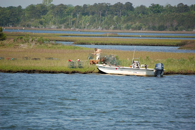
     Another common sight on this leg of the journey (actually on most of the trip since leaving Florida) were the crabbers seting out their traps.  I guess this guy stored his equipment on the banks of the waterway.  Once these guys get all their traps out, it can be an obstacle course for us to navigate through without getting one caught in the propeller.  So far, so good.


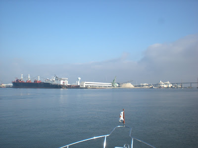
     Then, before we knew it, we were out of the wilds and back into civilization heading into Beaufort, N.C.  This is a shot of one of the phosphorus shipping operations along the waterway into town. 


       And I guess those phosphorus shipping titans were not such good pilots--just look at the damage they did to the bridge pilings right next to their operation.  It is always a little unnerving to cruise by a sight where someone else bashed in their boat.


     Even though this was a major shipping/industrial area, we cruised only a few miles past and into Beaufort, a charming seaside village with a rich history.  That will be my next post.


Tuesday, May 11, 2010

More North Carolina Coast

     Since we would be leaving our marina by the same route that we arrived the night before when we scraped the bottom, we paid attention to the tide tables and left when there was plenty of water!  No problems cruising on out, and you can judge the water level at this picnic spot next to the first bridge we went under (I think that's a parking meter next to the palm tree):


     Our first interesting sight as we cruised along the canal, was this rather unique lawn ornament.  We have seen the usual statues of deer, gnomes and an occasional plastic flamingo, but this is the very first, ah giraffe??

     From the water, it looked almost life-sized.  I sure would like to call these people up and find out the story behind it.
    
      Not much else interesting along today's route until we got onto Camp Lejeune property.  The ICW takes you right through the base.  It is the largest Marine base on the East coast with some 45,000 plus soldiers there.  Obviously, we had to deal with the usual military restrictions (eyes straight ahead, don't wander from the course--okay, just kidding), but there were warnings and restrictions posted all along the waterway.  And then we came across this sign:

No lights flashing, so off we go.

    Not more than 2 minutes after passing this sign, we felt, as well as heard, two loud booms and it scared the crap out of me.  All Art could say was, "Incoming!"  I swear I expected to see an explosion in the water in front of the boat.  Obviously, nothing happened, but it sure got our attention that we were on military property.  After that, we continued to hear distant explosions and saw a lot of destroyed military vehicles and huts, obviously bombed during their practice drills.
     The next thing Art said was, "Oh look, Ospreys!"  As you might remember from previous posts, we have seen Osprey nests on almost every channel marker (and I included a few photos), so I wasn't too excited until I realized he meant the plane and not the bird.  It was a pretty cool sight, but I wasn't quick enough to get a  photo.
     Once we traveled the 10 or so miles through Camp Lejeune, it was back to the usual scenery--swamps, marsh areas, a few scattered houses.  And there was always a house or two that caught our attention like this lovely pink one:


     As it got later in the day, the wind kicked up and we were glad to finally head into Dudley's marina in Swansboro, NC.  We had planned to fuel up, but the winds were so strong, they literally blew us into the dock and so we tied down for the night.  In the middle of the night, I was awakened by another loud boom and I thought the fuel dock had exploded.  No signs of fire around or anything else, and then it dawned on me that it was another bomb exercise at Camp Lejeune.  Wonder how the locals put up with the constant booms.  Next morning, we were out of there before another bomb dropped!
     Next stop:  historic Beaufort, NC

Wednesday, May 5, 2010

Goodbye South Carolina, Hello North Carolina

     We departed North Myrtle Beach on Friday (4/30), once again heading North on the ICW.  Just out of the marina, we entered an area known as "The Rockpile," which is exactly what the name implies.  We heard the usual horror stories and I was a bit unnerved--if you hit bottom here, you ended up with a hole in your hull (not a good thing for a boat) rather than just possible prop damage if you hit on a sandy bottom.  We motored on through without difficulty, but my stress levels have not been happy with the "potential" dangers we keep running into on this trip.  Shallow water continues to be the number one threat, as we were to find out later.
      Once through The Rockpile, it was an enjoyable ride with the usual sights.  Approximately 14 miles into our trip, we crossed into North Carolina, and the route brought us close enough to see the Atlantic Ocean along side of us, as you can see in this photo:

   The ocean is at the top--you can even see the surf.

     We also passed several inlets (in our case, they would have been outlets) where you can leave the ICW and head out to sea, but we aren't planning to do that on this trip.  Here is one inlet we passed:


     Once again, we found ourselves admiring the houses along the waterway, at least until we passed this one:

      My camera does not do justice to the color of this house--it was really purple and the first really upscale eyesore we have seen, at least until we came across this next one:

What were these people thinking?

     Just when we thought we had seen every possible type of housing along the waterways, we came upon our first trailer park:


     Fortunately, there were many more interesting homes to view as we went along.  There are a lot of new housing developments, and what could be more nautical than a lighthouse at the entrance to your development (even if it has no other purpose?):


     Even more new houses line the coast (wonder if they were thinking about hurricanes when they built these right on the Atlantic Ocean?):


    Lastly, to sum up the housing part of today's blog, here is one of my favorites:


     By mid day, we left the scenic and protected canal section of the ICW and headed onto the Cape Fear River (now there's a name that got my attention). This was another point where you could go right out into the ocean.  The wind and waves picked up, as well as the river traffic.  No more little yachts floating on the canals--now we were in with the big guys:


     There were also a lot of barges, car carriers and tugs to dodge around:


Cute little guy, huh?  But it wouldn't take much for him to knock us out of his way and send us to the bottom, so we steered clear of all commercial traffic.

     In spite of all that was going on in the river, we navigated the 12 mile stretch before heading back into protected waters, which also meant heading back into potential shallow spots.  All went well enough as we headed to our next stop at Wrightsville Beach, until we made the turn into Motts Channel near the marina.  Art was going quite slow, but all of a sudden we were going even slower as we scraped the sandy bottom.  Fortunately, we coasted on off the sand bar and were able to continue, but three boats after us were not so lucky and had to be towed off.  This group included some friends of ours who ended up with a bent prop and had to lay over an extra day for repairs.  Luck, and Art's skill, were with us today.